Facts about Papua New Guinea

Facts about Papua New Guinea

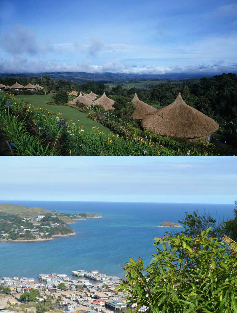
1. 600 islands: Papua New Guinea is an archipelago consisting of approximately 600 islands, which includes the eastern half of New Guinea. The total area of the islands is 462,840 km2

2. Self-sufficient communities: The vast majority (90-95%) of the population in Papua New Guinea live self-sufficiently, with most relying on fishing, hunting, agriculture or livestock farming. Although the mentality is quite relaxed with no rush and no stress, everything gets done sooner or later. Today, the country is very poor and crime is a growing problem

3. Ethnic groups: Papua New Guinea is one of the most heterogeneous nations in the world, home to hundreds of ethnically diverse indigenous groups. Most of these groups are descended from the Papuans, whose ancestors arrived in New Guinea thousands of years ago. Many of these tribes still have very little contact with the outside world and have some of the world’s most well-preserved folk traditions, which are still actively practiced

4. Name: The name ‘New Guinea’ comes from the Spanish explorer Yñigo Ortiz de Retez, who noticed the similarity between the people of New Guinea and the people of the African island of Guinea, which he had previously visited. With its 785,753 km2, New Guinea is the second largest island in the world (only surpassed by Greenland, which has an area of 2,130,800 km2)

5. Headhunters and cannibals: Although headhunters and cannibals are practically non-existent anymore, they used to occur on many of the islands of Papua New Guinea as part of ritual practices. One example of this was in 1901, when missionary Harry Moore Dauncey found 10,000 skulls in a longhouse on the island of Goaribari. Harry lived in Papua New Guinea for more than 40 years and his findings are now on display in a museum in Plymouth, UK

Fact: The weather is very changeable in Papua New Guinea. The climate is tropical
Attribution: petersbar + eGuide Travel – Flickr.com

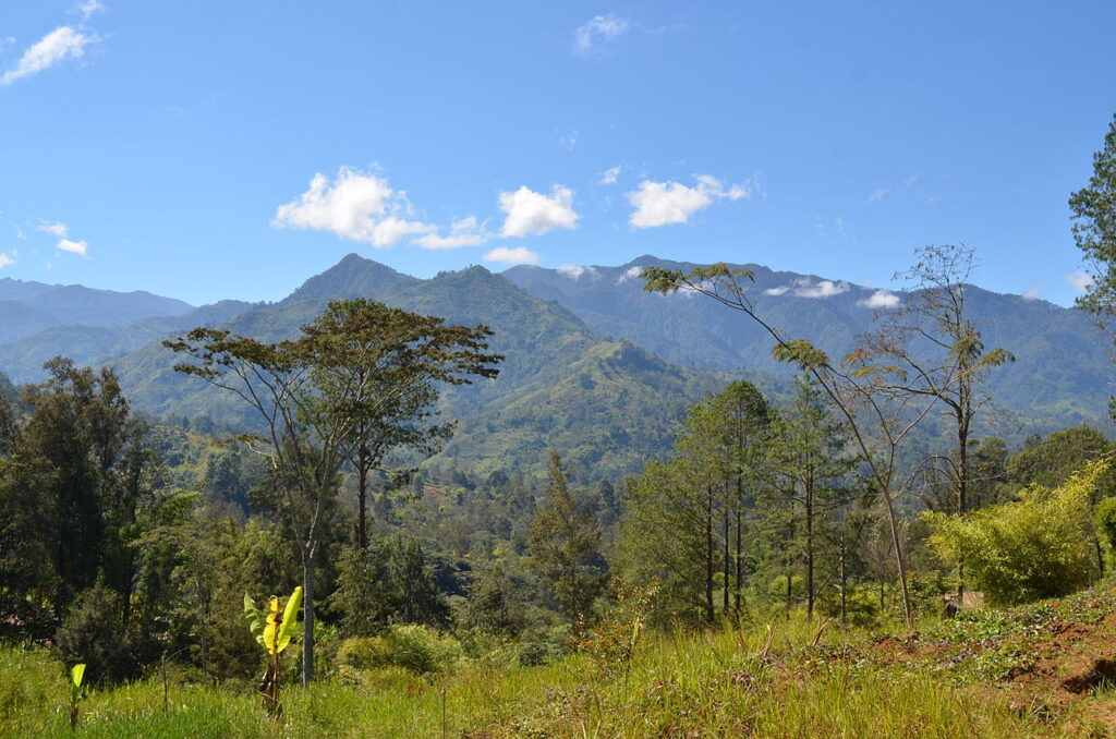
Fact: The weather in Papua New Guinea is generally very changeable and characterized by a tropical climate with dry and rainy seasons. Temperatures can drop as low as 14 degrees in the highlands (top) and as high as 36 degrees on the coast (bottom)


6. Natural disasters: Papua New Guinea is located in the so-called ‘Ring of Fire’, a belt of volcanoes located along the Asian and American Pacific coasts. Around 80% of all the world’s volcanic eruptions and earthquake occur in the Ring of Fire and Papua New Guinea is therefore at risk from these. In addition, the islands are sometimes hit by tsunamis, which may accompany earthquakes.

7. Weather and climate: Papua New Guinea has a moderate tropical climate, where there are exclusively dry and rainy seasons. During the rainy seasons there are high amounts of rainfall and otherwise the weather patterns are generally very unpredictable. Papua New Guinea’s extreme geographical variations mean that different areas of the country experience shifts in the rainy and dry seasons at different times of the year. Temperatures can be as low as 14 degrees in the highlands and as high as 36 degrees on the north coast. The sea temperature remains between 26 and 31 degrees throughout the year

8. Languages: English, Tok Pisin and Hiri Motu are the three official languages. The latter two are considered national languages, with English considered the most official of the three. Tok Pisin and Hiri Motu are also so-called ‘pigdin languages’ – simplified languages that have evolved as a means of communication between groups of people who do not share a common language. In addition, 836 local languages are spoken, the vast majority of which are spoken by less than 1,000 people

9. Discovery: New Guinea was discovered by Spanish and Portuguese explorers in the 16th century, but the islands remained virtually unknown in Europe until the 19th century, when the Germans colonized the north and the British the south. However, the British part was handed over to the newly formed Australia in 1905 and named the ‘Territory of Papua’. During World War 1, Australia took the German part of New Guinea and subsequently the entire area was under Australian/British control.

10. Modern times: During the New Guinea Campaign of 1942-1945, the Japanese attacked New Guinea, resulting in the deaths of around 216,000 Japanese, Americans and Australians. After 2. After World War II, the islands were renamed the ‘Territory of Papua and New Guinea’, but were simply called ‘Papua New Guinea’ in everyday life. On September 16, 1975, Papua New Guinea peacefully gained independence from Australia and there are still close ties between the two nations today (Australia is the country that helps Papua New Guinea the most)

Fact: Papua New Guinea is located in an area with many active volcanoes
Attribution: Russavia + tarotastic + rapidtravelchai – Flickr.com

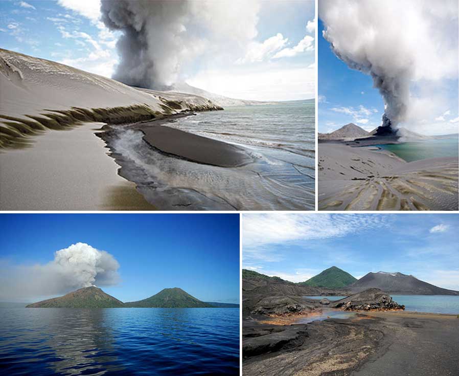
Papua New Guinea is located in the so-called ‘Ring of Fire’, where around 4/5 of the world’s volcanic eruptions occur. Here you can see the Tavurvur volcano near the town of Rabaul on the island of New Britain, which is part of Papua New Guinea

Geographic facts

  • Location: Oceania. An archipelago that includes the eastern half of New Guinea. Between the Coral Sea and the South Pacific Ocean. East of Indonesia
  • Country borders: Indonesia (820 km)
  • Coastline: 5,152 km
  • Climate: Tropical. Northwest monsoon (December to March), southeast monsoon (May to October). Small seasonal temperature fluctuations
  • Landscape: Mainly mountains and foothills with coastal lowland plains
  • Lowest point: 0 m (Pacific Ocean)
  • Highest point: 4,509 m (Mount Wilhelm)
  • Natural resources: Gold, copper, silver, natural gas, timber, oil and fish
  • Largest city: Port Moresby
  • Capital city: Port Moresby
  • Total area (square kilometers): 462.840,00 (2021)
  • Land areas (km2): 462.122,30 (2015)
  • Urban areas (km2): 415,40 (2015)
  • Agricultural land (km2): 14.410,00 (2021)
  • Agricultural area (% of total area): 3,18 (2021)
  • Forest area (% of land area): 79,10 (2021)
  • Plant species (higher), endangered: 179,00 (2018)
  • CO2 emissions (metric tons per capita): 0,56 (2020)

Demographic facts

Population

  • Population density (people per km2 total area): 21,97 (2021)
  • Population of largest city: 409.831,00 (2023)
  • Population growth (annual %): 1,83 (2023)
  • Population, total: 10.329.931,00 (2023)
  • Population growth in urban areas (annual %): n/a
  • Population in urban areas (% of total population): n/a
  • Population in rural areas (% of total population): 27,69 (2022)
  • Population growth in rural areas (annual %): 2,69 (2022)
  • Etniske grupper: Melanesians, Papuans, Negritos, Micronesians and Polynesians
  • Sprog: English, Tok Pisin and Hiri Motu are the three official languages. In addition, 836 local languages are spoken, most of which are spoken by less than 1,000 people
  • Religioner: 27% Roman Catholics, 69.4% Protestants (19.5% Evangelical Lutheran, 11.5% United Church, 10% Seventh-day Adventist, 8.6% Pentecostal, 5.2% Evangelical Alliance, 3.2% Anglican, 2.5% Baptist and 8.9% other Protestants), 0.3% Baha'i, 3.3% local denominations and others
  • Net immigration: -800,00 (2023)

Birth and death rates

  • Fertility rate, total (births per woman): 18,96 (2021)
  • Birth rate, gross (per 1,000 inhabitants): 25,11 (2022)
  • Teenage mothers (% of women aged 15-19 who have had children or are pregnant): 13,72 (2023)
  • Death rate, gross (per 1,000 people): 6,46 (2022)
  • Life expectancy at birth, women (years): 63,38 (2022)
  • Life expectancy at birth, men (years): 65,96 (2022)
  • Life expectancy at birth, all (years): 6,00 (2016)
  • Mortality caused by traffic accidents (per 100,000 inhabitants): 12,60 (2019)
  • Mortality, women (per 1,000 adult women): 168,94 (2022)
  • Mortality, male (per 1,000 adult males): 269,87 (2022)
  • Suicide rate, women (per 100,000 women): 1,60 (2019)
  • Mortality, infant (per 1,000 live births): 33,40 (2022)

Work, income and education

  • Wage earners, total (% of total labor force): n/a
  • Income share of the highest 10%: 1,90 (2009)
  • Income share of the lowest 10%: 32,05 (2021)
  • Unemployment, total (% of total labor force): 1,70 (2019)
  • Labor force, total: 69,17 (2022)
  • Workforce with basic education (% of the workforce): 63,15 (2022)
  • Labor force with medium education (% of labor force): 3.228.808,00 (2023)
  • Number of poor cf. national poverty limits (% of the population): 39,90 (2009)
  • Proportion of the population with moderate or severe food insecurity (%): 86,28 (2023)
  • School enrolments, primary school (gross %): 39,30 (2020)
  • Youth unemployment, all young people (% of total labor force aged 15 - 24): 21,89 (2022)
  • Young people not in education, employment or training, total (% of all young people): 12,10 (2018)
  • Literacy/literacy, total adults (% of population over 15): 61,60 (2010)

    Spending

  • Household (and NPIS) consumption expenditure (US$): 4,02 (1990)
  • Electricity consumption (kWh per inhabitant): 2,68 (2022)
  • Inhabitants using the Internet (% of the population): 39.000,00 (2020)
  • Mobile subscriptions (per 100 people): 48,42 (2021)
  • Number of smokers, total (over 15 years): 3,79 (2022)
  • Alcohol consumption per capita (litres of pure alcohol, expected estimates, +15 years): 2,86 (2023)

Business and tourism

  • Employers, total (% of total labor force): 3,17 (2022)
  • New companies (number of registrations): 4.109,00 (2020)
  • New businesses (new registrations per 1,000 inhabitants aged 15 - 64): 0,68 (2020)
  • Listed companies, total: 321.742,50 (2022)
  • Business conditions (0 = lowest grade to 100 = highest grade): 1,67 (2023)
  • International tourism, number of arrivals: 92.000,00 (2002)
  • International tourism, number of departures: 49,77 (2022)
  • Railway lines (total route kilometers): 1,67 (2023)
  • Railways, number of passengers transported (million passenger-kilometres): 109,50 (2018)

Health

  • Hospital beds (per 1,000 inhabitants): 31,00 (2009)
  • Suicide rate, men (per 100,000 men): 4,30 (2019)
  • Nurses and midwives (per 1,000 inhabitants): 0,51 (2021)
  • Doctors (per 1,000 inhabitants): 0,06 (2021)
  • Prevalence of HIV, total (% of population aged 15 - 49): 183,95 (2023)

Facts Papua New Guinea's economy

GDP and GNI

  • BNP (US$): 0,34 (2023)
  • GDP growth (annual %): 59,77 (2019)
  • GDP per capita (US$): 30.932.496.249,79 (2023)
  • GDP, KPP (US$): 2,68 (2023)
  • BNI (US$): 2.994,45 (2023)
  • GNI growth (annual %): 47.593.932.955,36 (2023)
  • Gross savings (% of GDP): 29.106.061.447,86 (2023)

Inflation, interest rates and consumer prices

  • Deposit rate (%): 5,33 (2021)
  • Lending rate (%): 2,30 (2023)
  • Inflation, consumer prices (annual %): 40,34 (2022)
  • Consumer Price Index (2010 = 100): 183,95 (2023)

Trade and production

  • Trade (% of GDP): 65,19 (2022)
  • Vareeksport (US$): 1,63 (2022)
  • Vareimport (US$): 514.942.525,14 (2022)
  • Food exports (% of merchandise exports): 19,23 (2021)
  • Food imports (% of goods imports): 100,55 (2022)
  • Food Production Index (2004 - 2006 = 100): 5.528.708.618,01 (2004)
  • Index of animal production (2004 - 2006 = 100): 9,50 (2019)

Industry

  • Industry (including construction), value added (% of GDP): 3,23 (2004)
  • Industry (including construction), value added (US$): 30,42 (2004)
  • Industry, value added (% of GDP): 8,34 (2023)
  • Industry, value added (US$): 107,71 (2022)

Military

  • Armed forces, total: 4.000,00 (2020)
  • Military expenditure (% of GDP): 12.036.000.000,00 (2023)
  • Military Expenditure (US$): 3.019.000.000,00 (2023)

Others

  • Current health expenditure (% of GDP): 5,33 (2021)
  • Labor tax and contribution (% of company profit): 12.749.924.642,47 (2022)
  • Development Assistance (ODA) received per capita (US$): 0,33 (2022)
  • Social contributions (% of income): 97.487.775,75 (2022)